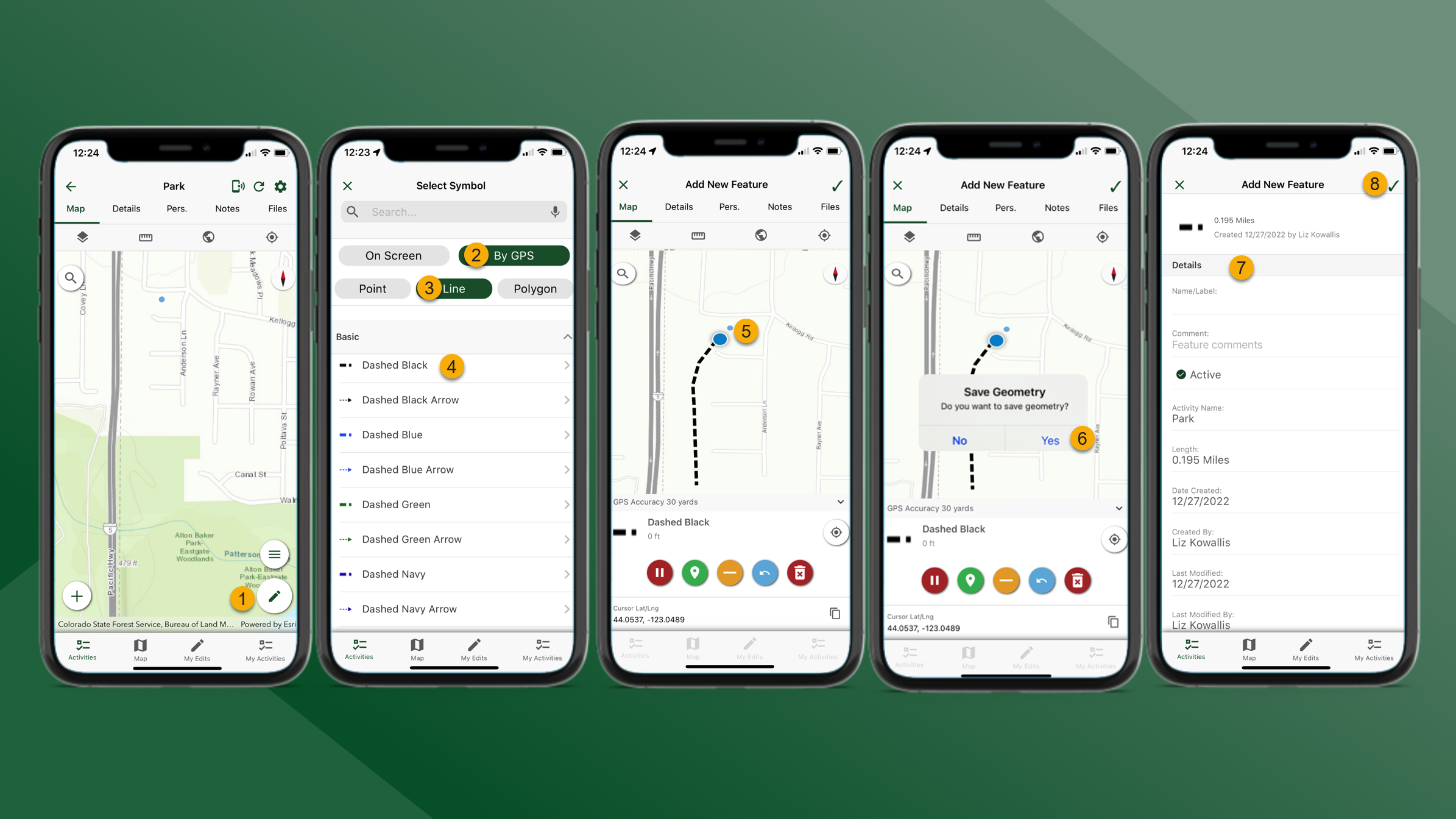
Create Map Features - By GPS
Location permission on the mobile device must be set to “Always” to enable Background GPS data collection for mapping.
To create map features by GPS, follow the steps outlined below:
From the Map tab for the selected Activity tap
at the bottom of the screen.
Select By GPS
Select feature type
Select feature symbol
The map will zoom to the user’s location. Begin walking to collect GPS data. Use the Mapping Tools buttons collect the preferred data.
Mapping Tools – By GPS
Tap
to pause
Tap
to add a vertex
Tap
to remove a vertex
Tap
to undo
Tap
to discard the feature
When finished tap
in the top right corner of the screen and then tap Yes.
Update the Details as necessary.
Tap