Watershed Protection Risk
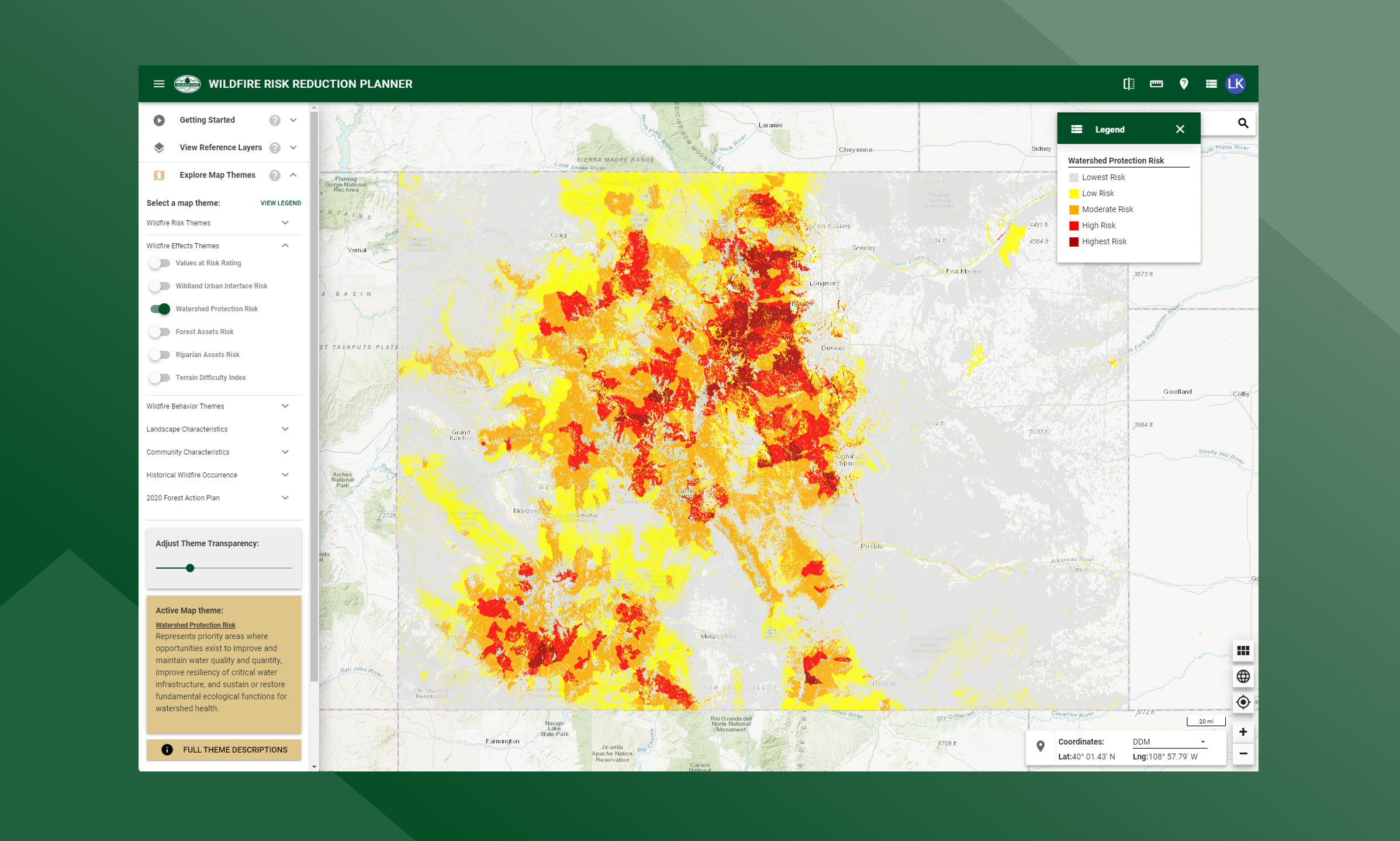
A measure of the risk to Watershed Protection Areas based on the potential negative impacts from wildfire.
In areas that experience low-severity burns, fire events can serve to eliminate competition, rejuvenate growth and improve watershed conditions. But in landscapes subjected to high, or even moderate-burn severity, the post-fire threats to public safety and natural resources can be extreme.
High-severity wildfires remove virtually all forest vegetation – from trees, shrubs and grasses down to discarded needles, decomposed roots and other elements of ground cover or duff that protect forest soils. A severe wildfire also can cause certain types of soil to become hydrophobic by forming a waxy, water-repellent layer that keeps water from penetrating the soil, dramatically amplifying the rate of runoff.
The loss of critical surface vegetation leaves forested slopes extremely vulnerable to large-scale soil erosion and flooding during subsequent storm events. In turn, these threats can impact the health, safety and integrity of communities and natural resources downstream. The likelihood that such a post-fire event will occur in Colorado is increased by the prevalence of highly erodible soils in several parts of the state, and weather patterns that frequently bring heavy rains on the heels of fire season.
In the aftermath of the 2002 fire season, the Colorado Department of Health estimated that 26 municipal water storage facilities were shut down due to fire and post-fire impacts. The potential for severe soil erosion is a consequence of wildfire because as a fire burns, it destroys plant material and the litter layer. Shrubs, forbs, grasses, trees and the litter layer disperse water during severe rainstorms. Plant roots stabilize the soil, and stems and leaves slow the water to give it time to percolate into the soil profile. Fire can destroy this soil protection.
The risk index has been calculated by combining the Watershed Protection data with a measure of fire intensity using a Response Function approach. Those areas with the highest negative impact (-9) represent areas with high potential fire intensity and high importance for ecosystem services. Those areas with the lowest negative impact (-1) represent those areas with low potential fire intensity and a low importance for ecosystem services. The response function outputs were combined into 5 qualitative classes.