Navigating the Map
The interface is similar for all the applications, however, these examples will use the Wildfire Risk Public Viewer.
To Zoom to a specific location, follow the steps outlined below:
Enter an address or place in the Search Bar located in the top right-hand corner
All places matching that location will be listed in a panel that appears below the search bar as you type
Click on any of the results to zoom on the map to that location. The location will be identified on the map by a red dot.
Locations are limited to the state of Colorado.
Zoom and pan using the map:

Use the zoom in and out buttons located in the lower right corner
These will zoom in and out on the center of the map
Zoom to full extent:

Use the globe icon located in the bottom right corner of the map to zoom to the original full extent of the map
Zoom and pan using the mouse:
Pan - left click and drag the map
Incremental zoom - Use the mouse wheel to zoom in and out
Zoom in & center - Double left click the map
Zoom to current location:

Click the GPS crosshairs icon located in the bottom right corner of the map
This will zoom and center the map on your location
The first time this tool is used, the browser will prompt for permission to use your location.
Allow the browser to use your location for this tool to work properly.
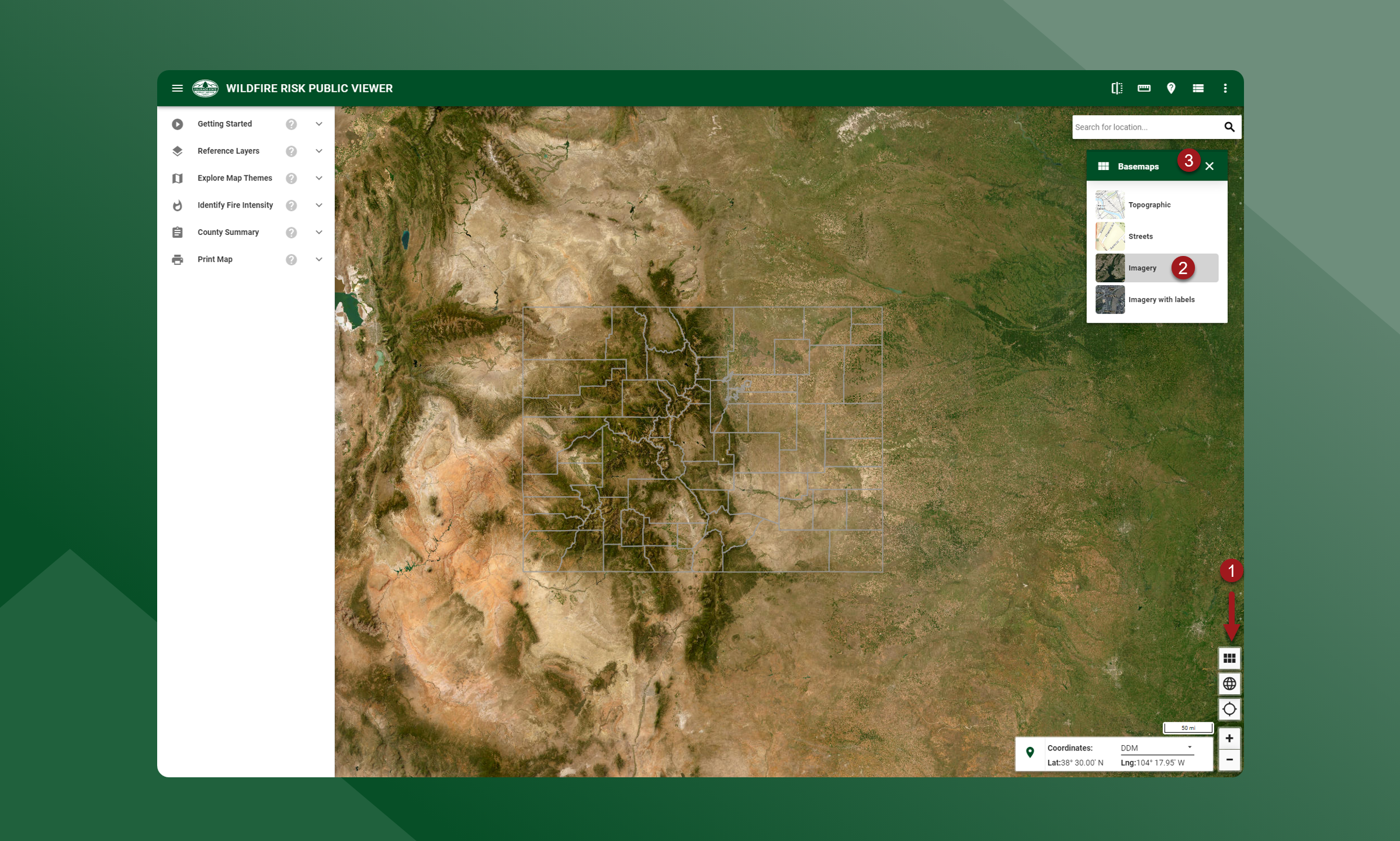
Changing a Basemap
To select or change basemaps, follow the steps outlined below:
Click the basemaps icon in the bottom right corner of the map. A pop up will appear will the available basemaps
Select a map and it will be outlined in grey indicating it is active
Click the X in the top right corner to dismiss the basemap pop up