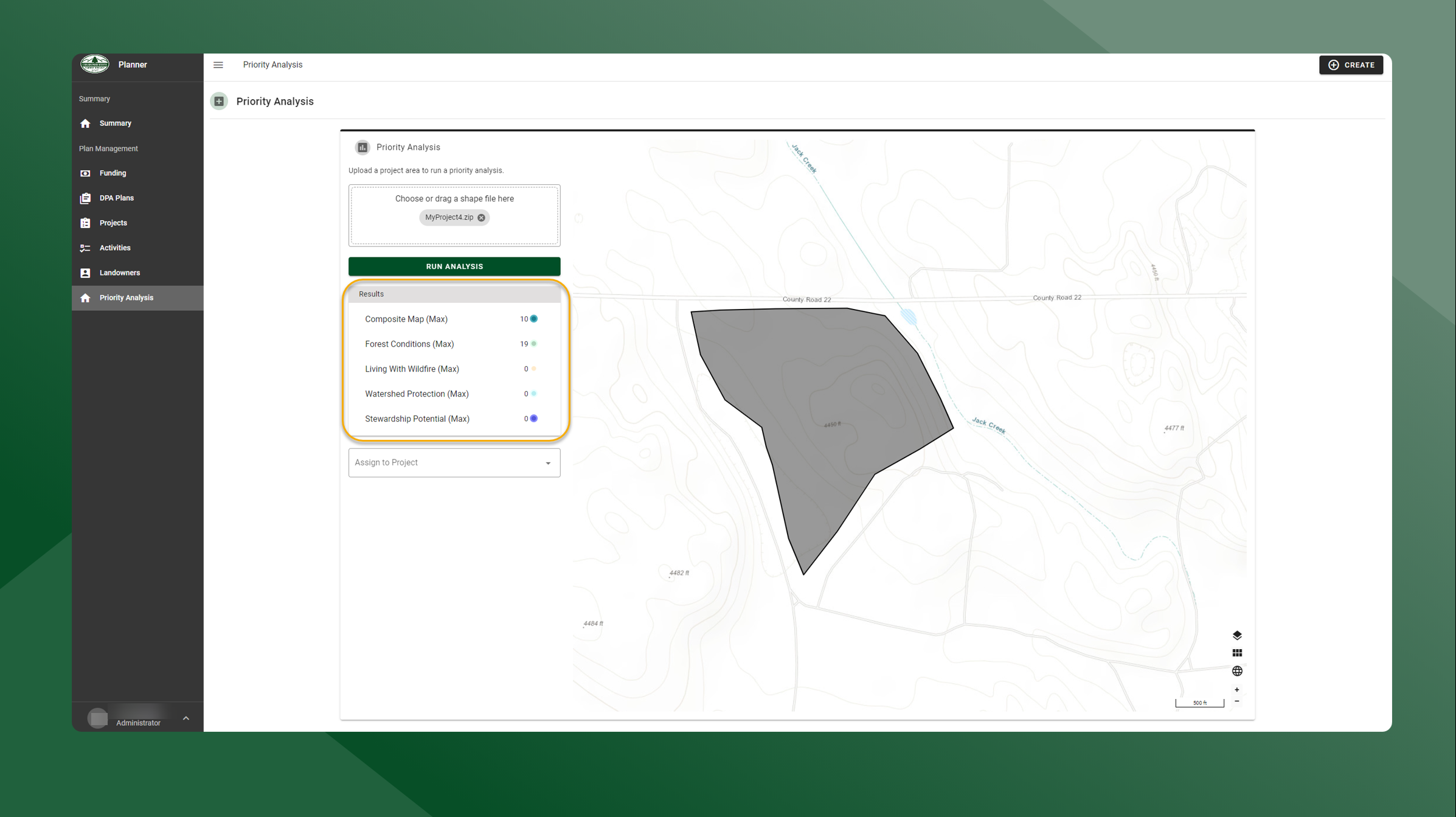
Priority Analysis Overview
This tool requires a zipped shapefile and runs an analysis using the Composite, Forest Conditions, Living With Wildfire, Watershed Protection, and Stewardship Potential by finding the highest cell value in each of the layers that fall within the uploaded polygon.
The higher the value, the higher the priority for a particular layer and the higher the project may be for funding or work.
CSFS can then rank projects depending on funding source and the type of project and then compare it to other projects targeting that same funding.

